Victoria’s Volcanic Plains
Active volcanoes were part of western Victoria’s landscape from about 4.5 million years ago until as recently as 7,200 years ago, forming one of the World’s largest basalt plains with more than 400 volcanos mapped. Aboriginal people would have witnessed some of these eruptions.
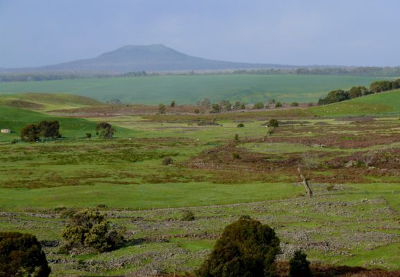
The Western Basalt Plain stretches from Melbourne to Portland and as wide as Colac to Beaufort. It consists of vast open areas of grasslands, large, shallow lakes, small patches of woodland and stony rises from the once hot lava flows. The low peaks of dormant and extinct volcanoes dot the landscape.
During pastoral settlement of the volcanic plains, stone was used to construct hundreds of kilometres of dry stone walls and has become a characteristic feature of the Western District landscape.
Mount Napier, south of Hamilton, consists of a shallow crater, at least 15 smaller basalt and scoria eruption points and elongated lava flows extending along small valleys. The final major eruption of lava flowed along the valley of Harmans Creek for 24 kilometres.
Still visible near Wallacedale today are lava ridges and clusters of lava tumuli which are circular mounds of rock up to 10 metres high and 20 metres in diameter. This is the only place in Australia where tumuli are found.
The Byaduk Caves are considered the most extensive and accessible lava caves in Australia. The largest tunnels are up to 18 metres wide, 10 metres high and extend 20 metres below the surface. The caves are accessed through collapsed sections of ‘lava tubes’ which carried lava flows beneath a solidified crust. These tunnels were left after the molten lava flowed away, leaving ‘tide marks’ on the walls.
The lava from Mount Rouse, at Penshurst, flowed 60 kilometres south to the coast at Port Fairy. The path of the lava can be seen today along creek valleys, as stony rises, lava tubes and caves, and at the Port Fairy beach extending out to sea.
The Wannon and Nigretta Falls were created by lava flows that surged upstream to the Wannon River. The water cascades over hardened basalt lava.
Tower Hill, west of Warrnambool, is one of the largest Maar volcanoes in the world. It was formed about 25,000 years ago when rising magma met layers of water-saturated sedimentary rock below the ground. This super-heated steam exploded with the power of a small nuclear bomb, blasting magma and shattered rock high into the air. Inside the 3km wide crater are smaller and younger scoria volcano cones.
|